If you’re planning to build or develop land in Victoria, it’s important to understand how flood-related planning controls may affect your property. One of the most common and significant of these is the Land Subject to Inundation Overlay (LSIO).
What Is the LSIO?
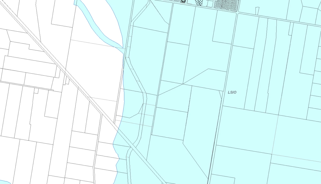
In Victoria’s planning system, the Land Subject to Inundation Overlay (LSIO) is used to identify land that may be affected by flooding, particularly from waterways and open drainage systems. It’s a key control in local planning schemes designed to manage flood risk and guide development in flood-prone areas.
The LSIO applies primarily to floodplains, which are low-lying areas near rivers, creeks, or coastal zones that are vulnerable to inundation during heavy rain or major flood events.
Why Is the LSIO Important?
The LSIO plays a critical role in floodplain management. Its primary purpose is to:
Ensure that new development is compatible with flood hazards
Prevent any building or works that would worsen flood impacts on the site or neighbouring land
Protect the natural function of waterways and flood storage areas
Support safe and sustainable development through early consideration of flood risks
What Does the LSIO Mean for Property Owners?
If your land is within an LSIO zone, development is not prohibited, but it is regulated. Here’s what you need to know:
Planning Permits Are Required: You’ll need a planning permit for most buildings, structures, or land subdivision within the LSIO area—even for works that might not typically require one in other zones.
Flood Risk Must Be Considered: Planning applications must demonstrate how the proposed development responds to the identified flood risk. This includes site levels, flood levels, and proposed floor heights.
Referral to Authorities: Your application will likely be referred to the relevant floodplain management authority, such as Melbourne Water or a local council, for review and approval.
Common Examples of LSIO Areas
The LSIO is typically applied to:
Land adjacent to rivers, creeks, and stormwater drains
Areas with natural floodways or basins
Coastal zones at risk of sea level rise or storm surge
LSIO vs Other Flood Overlays
Understanding how the LSIO compares to other flood-related overlays can help clarify your planning obligations:
Floodway Overlay (FO): Applies to areas with high-velocity flood flows—these areas carry the main volume of floodwater during a flood event and pose higher development risks.
Special Building Overlay (SBO): Targets areas prone to overland stormwater flooding due to limited drainage capacity, often in urban environments.
Urban Floodway Zone (UFZ): A zoning control rather than an overlay, used where the flood risk is extreme. Development is usually highly restricted.
Each of these overlays serves a different purpose but shares the common goal of managing flood impacts on people, property, and the environment.
How VIC Feature Survey Can Help
At VIC Feature Survey, we assist property owners, developers, and builders by providing accurate feature and level surveys tailored to LSIO-affected land. Our surveys:
Show existing ground levels in relation to the Australian Height Datum (AHD)
Identify flood-prone zones on your site
Provide detailed, council-ready Feature Survey in AHD for planning permits
Understanding your site’s flood risk is the first step toward a successful development. Whether you’re building, subdividing, or renovating in an LSIO zone, VIC Feature Survey can provide the accurate information and professional support you need.
Contact us to get started with a detailed site survey and expert planning advice.
Useful link: