Australian Height Datum (AHD)

VIC Feature Survey provides precise AHD survey across Melbourne and Victoria construction and development projects require for accurate height measurements. Our surveyors connect your site to the Australian Height Datum — the national vertical reference standard — ensuring your project meets council requirements for flood risk assessment, drainage design, and building permit applications.
Australian Height Datum (AHD) GPS

What is the Australian Height Datum (AHD)?

The Australian Height Datum (AHD) is the standard vertical reference system used for measuring heights across Australia. It is an essential part of surveying, ensuring that all heights are consistent and accurate for projects such as construction, engineering, and infrastructure development. The AHD provides a common reference point for land surveyors, engineers, and architects to work with reliable and uniform data.

Why is AHD Important for Your Projects?

Using AHD as a reference for height measurement is critical to ensuring that your project complies with national standards. Whether you’re involved in:

  • Building projects: Ensuring foundations are at the correct level.
  • Flood risk assessments: Understanding the elevation of the land relative to flood zone and LSIO.
  • Infrastructure development: Ensuring roads, bridges, and other structures are built with accurate height data.

Accurate height measurements are necessary for the safety, functionality, and regulatory compliance of your project.

Flood zone & LSIO

Flood-prone land refers to areas that are susceptible to flooding during extreme weather events, typically a 1% annual exceedance probability event (1% AEP), previously known as the 1 in 100 year flood. These areas are determined based on detailed flood mapping and are subject to specific development controls to mitigate flood risks.

Councils are responsible for investigating flood impacts within their municipalities and regulating developments within flood-prone zones. For developers, engineers, and architects, understanding the flood risk and obtaining accurate elevation data is crucial to ensuring that projects are resilient to flooding.

The Land Subject to Inundation Overlay (LSIO) is a planning control that identifies areas of land that are at risk of flooding. This overlay is designed to encourage early consideration of flood risks during the planning and development process.

The LSIO provides guidance on how developments should respond to potential flood hazards, ensuring that properties in these areas are built to withstand and adapt to flood risks. 

Why Choose VIC Feature Survey?

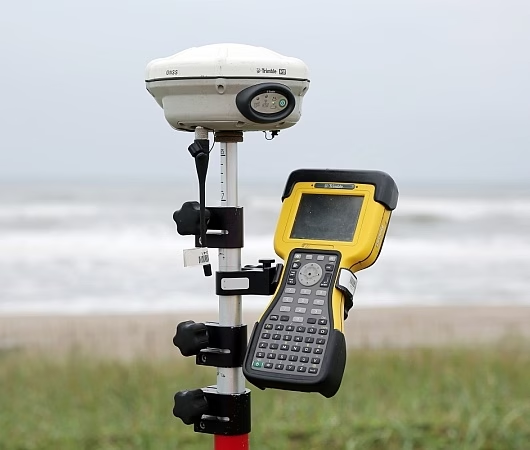
  • Accurate and Reliable Data: Our team uses advanced equipment (GSP) and techniques to ensure the highest accuracy in height measurement, including flood risk assessments.
  • Experienced Surveyors: We are professionals with extensive experience in working with AHD, LSIO, and flood-prone zones.
  • Timely Service: We understand the importance of meeting deadlines in construction and planning, and we ensure that our results are delivered on time.
  • Compliant with Standards: Our services comply with all Australian surveying standards and regulations, including flood risk assessments.

Contact Us Today

Whether you’re starting a new project or need accurate height data for existing developments, VIC Feature Survey is here to assist. Contact us today for a consultation and to learn how our AHD services can support your project. 

To read more about AHD, visit our blog.

Frequently Asked Questions

What is an AHD connection and why do I need one?
An AHD (Australian Height Datum) connection links your site levels to the national height reference system. It is required by many Melbourne councils for planning permit applications, flood overlay assessments, drainage design, and building permits.
 
When does a council require an AHD connection in Victoria?
Councils typically require an AHD connection when a property is in a flood overlay zone, when applying for a planning permit for a new dwelling or major extension, or when a drainage or structural engineer requires height data referenced to a national datum.
 
Can AHD connection be added to a feature survey?
Yes. We commonly combine an AHD connection with a feature and level survey in a single site visit, saving you time and cost.
 
How long does an AHD connection survey take?
When combined with a feature survey, the AHD connection adds minimal time to the site visit. As a standalone service, most AHD connections are completed and delivered within 3–5 business days.
 
What is the difference between AHD and arbitrary datum?
An arbitrary datum is a local reference point used only for a single project. AHD is a national standard that allows heights to be compared across different sites and used for flood modelling, council planning, and engineering design.