At VIC Feature Survey, we specialize in cadastral surveying, which plays a vital role in defining property boundaries. Our licensed surveyors provide precise and legally compliant surveys to ensure your land boundaries are accurately identified, recorded, and maintained.
What is Cadastral Survey?
Cadastral surveying is the practice of determining property boundaries based on land ownership laws. It involves interpreting boundary locations, understanding land ownership status, and recording rights, restrictions, and interests associated with a property. This is crucial when creating or re-establishing property boundaries, especially during land subdivisions or legal property transfers.
In Victoria, only licensed surveyors under the Surveying Act 2004 are authorized to perform cadastral surveys. This ensures the accuracy and reliability of land data that supports the state’s property registration system.
Why Are Cadastral Surveys Important?
Cadastral surveys are essential for several purposes:
New Property Developments: Creating new land parcels for ownership and registration.
Boundary Definition: Re-establishing property boundaries for existing parcels.
Property Disputes: Resolving boundary conflicts or discrepancies between neighbors.
Easement Creation: Determining land-use rights and restrictions for property access.
Our expert surveyors at VIC Feature Survey provide clear and reliable cadastral plans, which are essential for legal purposes and form the foundation of the Victoria Cadastre.
Key Cadastral Survey Services
1. New Land Parcel Creation
When developing a new estate or subdivision, a cadastral survey is necessary to clearly define and register new land parcels.
2. Title Re-establishment Surveys
For existing properties, these surveys redefine and confirm the boundaries, especially for landowners wanting to resolve disputes or subdivide their property.
3. Identification Surveys
These surveys determine the exact dimensions, areas, and location of improvements (e.g., buildings, fences) on a property.
4. Easement Surveys
We assess and map land access rights, ensuring clear definitions of property usage for easements and other legal interests.
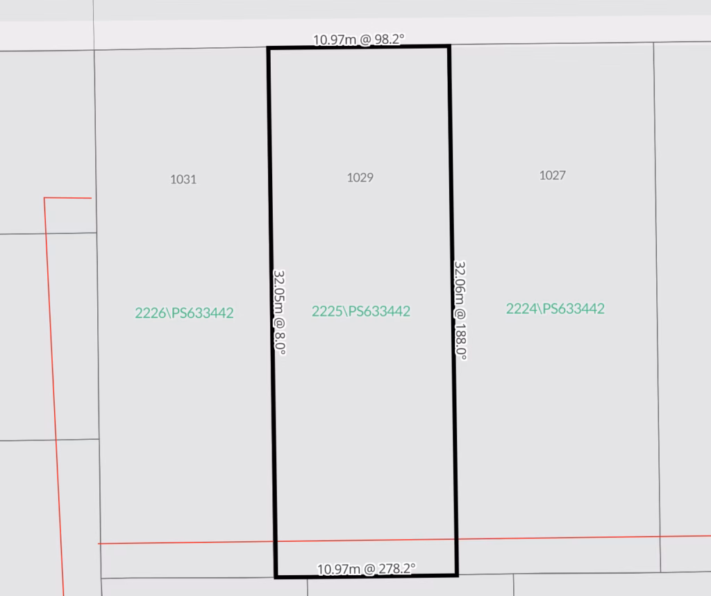
What is a Cadastral Plan?
A cadastral plan is a legal document that shows the exact location and dimensions of land parcels. It is prepared by a licensed surveyor and accurately represents the land’s boundaries at the time of the survey. Cadastral plans are crucial for creating new property titles or re-establishing boundaries in legal records.
Cadastral Mapping vs. Cadastral Plans
While cadastral maps are used for general land administration and do not hold legal status, cadastral plans are legally binding documents used for property registration and transfer. Cadastral maps provide a broader view of land parcels and are often created for reference purposes, while cadastral plans are precise and contain specific legal information.
How We Work
At VIC Feature Survey, we use the latest surveying technology to ensure the highest accuracy in our cadastral surveys. Our process includes:
Consultation: Discuss your project requirements and scope.
Site Visit: Our licensed surveyor conducts a field survey to gather essential data.
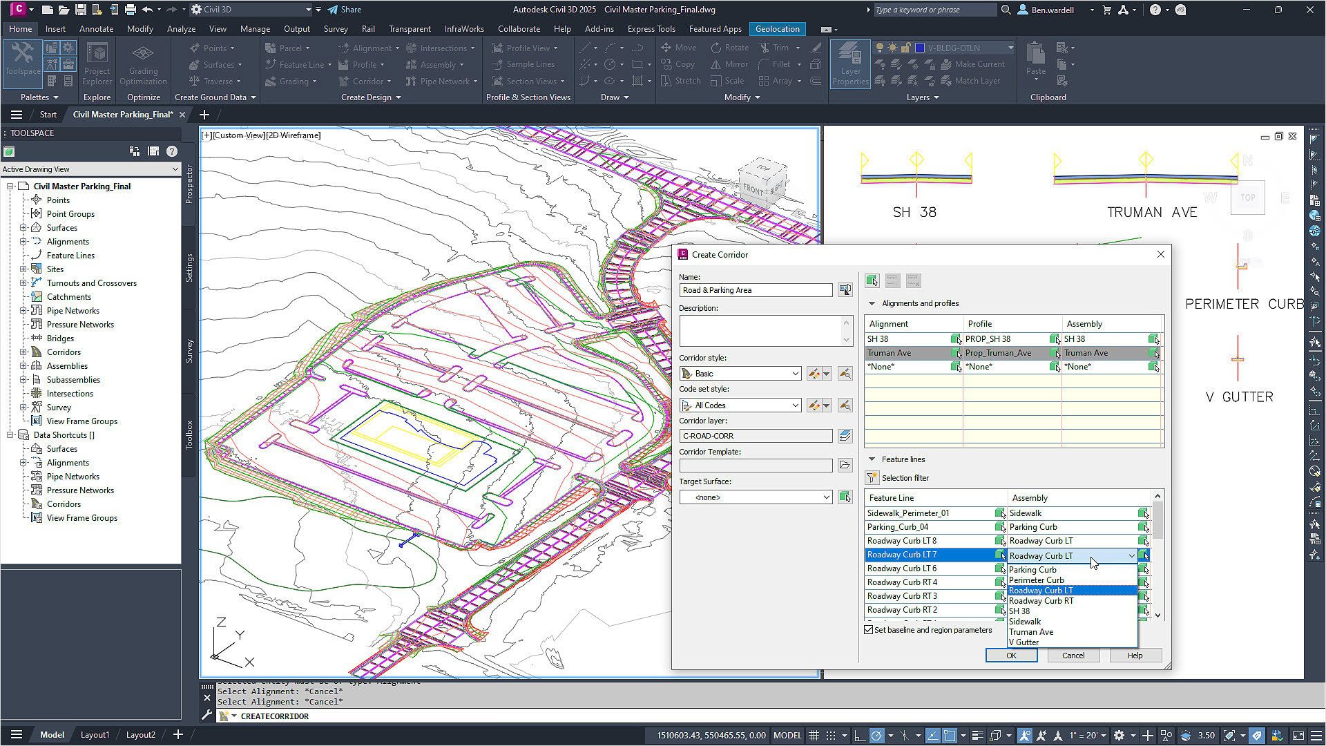
Data Processing: We use Survey software (AutoCAD Civil 3D) to process the survey data.
QA and Review: All survey plans undergo an independent quality assurance audit for accuracy.
Final Deliverables: We provide your cadastral survey plans in formats PDF and AutoCAD.
If you need professional cadastral survey services, VIC Feature Survey is your trusted partner. Whether you’re a developer, property owner, or involved in a boundary dispute, our expert surveyors are here to help. Contact us today to discuss your project.
Useful link: