At VIC Feature Survey, we leverage cutting-edge technology to deliver accurate and efficient surveying solutions. One of the most powerful tools in our workflow is Autodesk Civil 3D—an industry-leading software designed for civil engineering and land surveying professionals.
What is Autodesk Civil 3D?
Autodesk Civil 3D is a comprehensive design and documentation software tailored for civil infrastructure projects, including land development, road design, and surveying. It provides dynamic, data-driven workflows that streamline project efficiency and improve collaboration.
How VIC Feature Survey Uses Civil 3D for Precision Surveying
At VIC Feature Survey, we integrate Civil 3D into our daily operations to enhance accuracy, efficiency, and productivity. Our expertise in this software allows us to provide high-quality deliverables while optimizing project timelines. Here’s how we utilize Civil 3D:
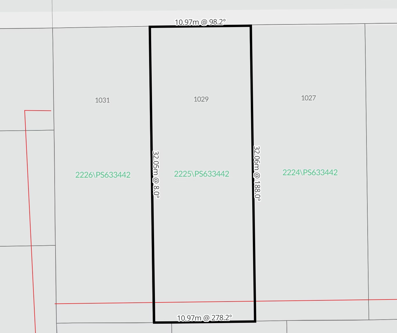
1. Accurate Terrain Modeling & Surface Analysis
Civil 3D enables us to create highly detailed surface models based on real-world topographic data. This is essential for precise land grading, drainage planning, and volume calculations.
2. Streamlined Data Management & Collaboration
With Civil 3D, our team can efficiently handle large datasets, ensuring seamless integration between fieldwork and office analysis. The software’s cloud-based collaboration tools also allow for real-time updates and coordination with engineers, architects, and developers.
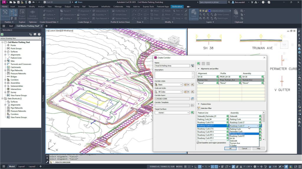
3. Automated Design Workflows
Civil 3D automates many repetitive tasks, such as corridor modeling, profile generation, and section views. This not only reduces human error but also saves valuable time, allowing us to deliver results faster.
4. Advanced Alignment & Roadway Design
For projects involving road networks, Civil 3D provides powerful alignment and profile tools that help us design precise and efficient road layouts, intersections, and grading plans.
5. Seamless Integration with GIS & BIM
By integrating with GIS (Geographic Information Systems) and BIM (Building Information Modeling), Civil 3D ensures that our surveying data remains accurate, up-to-date, and easily accessible for future development projects.
Why Choose VIC Feature Survey?
At VIC Feature Survey, we combine expert knowledge, advanced technology, and industry best practices to deliver exceptional surveying services across Victoria. Our use of Autodesk Civil 3D ensures that we meet the highest standards of accuracy and efficiency, providing clients with reliable data for informed decision-making.
Looking for professional surveying solutions?
Get in touch with VIC Feature Survey today and experience the benefits of precise, technology-driven land surveying with Autodesk Civil 3D.
Contact us now to discuss your project requirements!
Helpful Link: